← Publications / Climate Change & Earth Observation
Alberta Wells Dataset: Pinpointing Oil and Gas Wells from Satellite Imagery
Pratinav Seth*, Michelle Lin*, Brefo Dwamena Yaw, Jade Boutot, Mary Kang, David Rolnick
* Equal contribution
Abstract
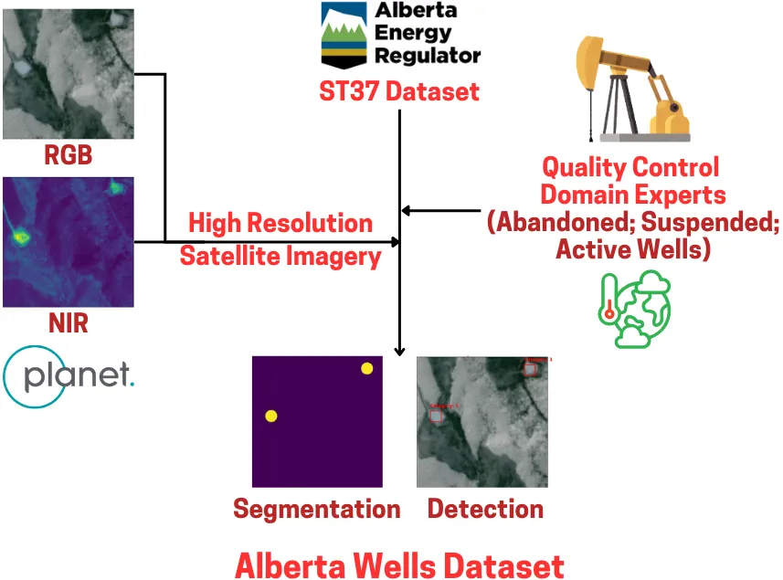
Millions of abandoned oil and gas wells are scattered across the world, leaching methane into the atmosphere and toxic compounds into the groundwater. Many of these locations are unknown, preventing the wells from being plugged and their polluting effects averted. Remote sensing is a relatively unexplored tool for pinpointing abandoned wells at scale. We introduce the first large-scale benchmark dataset for this problem, leveraging medium-resolution multi-spectral satellite imagery from Planet Labs. Our curated dataset comprises over 213,000 wells (abandoned, suspended, and active) from Alberta, a region with especially high well density, sourced from the Alberta Energy Regulator and verified by domain experts. We evaluate baseline algorithms for well detection and segmentation, showing the promise of computer vision approaches but also significant room for improvement.
Cite
@inproceedings{seth2025alberta,
  title         = {{Alberta Wells Dataset: Pinpointing Oil and Gas Wells from Satellite Imagery}},
  author        = {Pratinav Seth and Michelle Lin and Brefo Dwamena Yaw and Jade Boutot and Mary Kang and David Rolnick},
  booktitle     = {ICML 2025 / CCAI ICLR 2025},
  year          = {2025},
  eprint        = {2410.09032},
  archivePrefix = {arXiv},
  url           = {https://arxiv.org/pdf/2410.09032}
}